Can a levee save a historic town in the Southern Zone?
Flood have been a part of life in Ciudad Cortés since its founding. We visit the past, present and future of this community to understand its relationship with these emergencies.
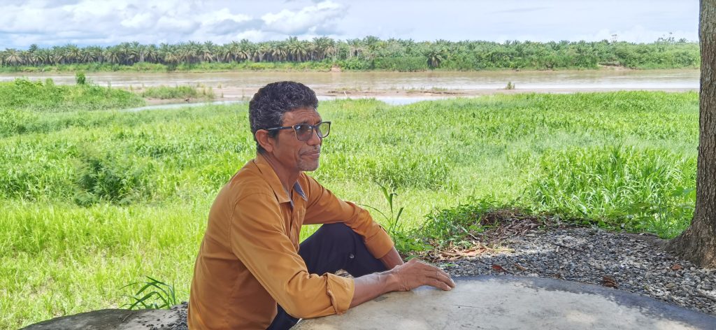
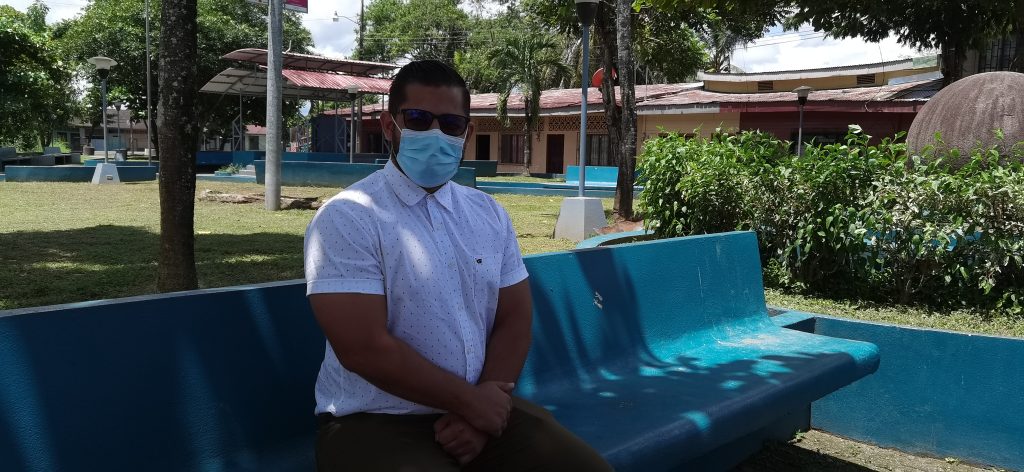
Javier Barrantes Rosales, born and raised in Puerto Cortés, clearly remembers the golden age of his community in the 1960s and 70s. Back then, it was a prosperous place, full of life and with a buoyant economy. He visits the pier frequently, a place that has been strategic for the development of Costa Rica’s Southern Zone, especially at the peak of the banana industry. Through this place passed all the merchandise, materials and people who were a part of that time. When Javier is there, indelible memories move through his mind.
Puerto Cortés has an area of 226 square kilometers and approximately 9,000 inhabitants. According to the National Institute of Statistics and Census (INEC), about 7,500 of these live in the central district. In 1910, the area was colonized by Chiricanos, as the original people of Chiriquí in Panama are called, and some Costa Ricans, who established a hamlet called El Pozo in 1912. On September 14, 1934, through executive decree No. 121, the district was given the name of Cortés, in honor of the then-President León Cortés Castro (1936-1940), and the village of El Pozo was renamed Puerto Cortés.
Floods have been a part of life in the town since its origins. Geologist Julio Eduardo Madrigal Mora of the National Emergency Commission (CNE) explains this in Report 894-f, “Cantón de Osa: Characteristics of the Interior Basin of the Río Grande de Térraba.”
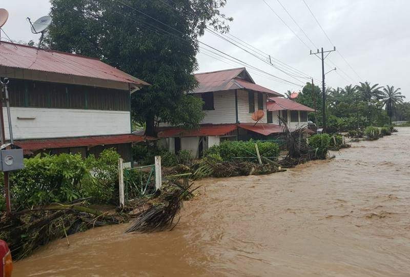
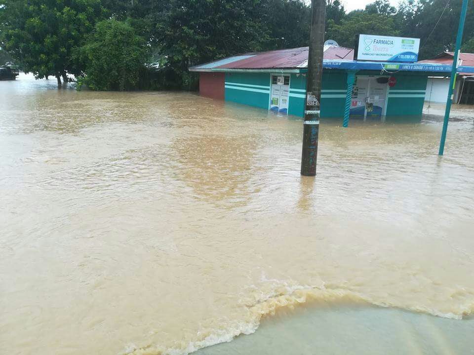
“The serious problems that the floods have generated in the town of Puerto Cortés, both in farms and in infrastructure, are referenced in 1916, 1954, and 1955”, the document relates. “on a smaller scale, they caused damaged to the avenues oin 1971, 1973, 1981, 1988, 1993, 1996, 2010, 2017 and 2020.”
The causes are various, but the same CNE document indicates that one of the primary difficulties is that after the main bridge, the Térraba River forks into several arms, generating fluvial accumulations. The primary towns in the area are located on the banks, where the riverbed curves; many of the houses were built on flat land where recent floods have deposited materials.
The history of the actions taken to mitigate the effects of the floods is complex, beginning in 1956, when the United Fruit Company built a dam and also dredged much of the Térraba River in response to the great flood of 1955. That flood destroyed part of the company’s plantations and infrastructure. Later, however, once the banana company had left the area, the problems returned.
Other solutions that have been implemented are new regulations for building height, and even the relocation of the population to the Ojo de Agua sector, about 3 kilometers north of Puerto Cortés.
Today, this community—shaped by a multinational company that is already absent, loved by inhabitants who remember more prosperous days, threatened by the storms that are increasing in Costa Rica as a consequence of the effect of climate change in the region—faces a series of complicated questions. Can a dam save this historic town? Or will relocation be the answer?
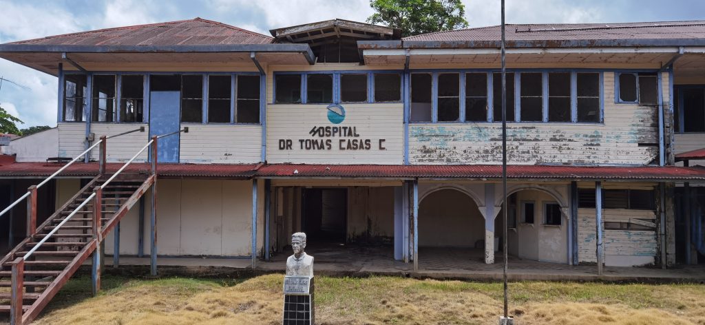
“Let’s remember that Puerto Cortés was the main entrance, the biggest development pole of the South Zone,” says Javier. “It is not easy to bury so much historical wealth of our people. There are our roots, and those of a whole banana culture. The Dr Tomás Casas Hospital was inaugurated on March 19, 1942 and moved in 2008. Imagine the number of people who were born in this hospital. All those generations demand that Puerto Cortés survives.”
Floods and their role in history
The history of the area—and its complicated relationship with the storms and floods that affect it—goes hand in hand with the history of the relationship between Ciudad Cortés and the United Fruit Company, the multinational company whose shadow and impact are still felt in several coastal regions of Costa Rica. In this part of the country, that history began in 1938 when the company began its cultivation of bananas in the Pacific, setting up administrative offices on the southern bank of the Térraba river, a place that was called La Administración.
The company enjoyed certain tax benefits that allowed it to carry out a very profitable activity in Puerto Cortés and Puerto Jiménez; later, it established plantations around Palmar and developed transport infrastructures (rail and port) in Golfito.
In 1984, as a result of the fall in international fruit prices, United Fruit left the area, leaving some 20.000 workers unemployed. As a result, much of the area’s economic activity came to a halt, leaving behind a dependent and depressed economy. Today, Puerto Cortés has significant palm crops and is looking to livestock and agriculture as an exit from the crisis caused by the departure of the banana company all those years before. Fortunately, because it is the first district of the Osa Canton, it houses public institutions, which helps sustain the economy.
The banana company also left something else behind: an intervention that affected the response to emergencies in the area. After the great floods of 1955, the Compañía Bananera built a dam to protect Puerto Cortés (as Ciudad Cortés was known then) from rising rivers.
“The 1955 flood was one of the largest Osa has seen,” recalls community leader Oldemar Quesada Fernández, “surpassed only by Nate in 2017. At that time, the banana company was already settling down and seeing the need to maintain the Térraba River basin. The company built a series of canals to drain their lands in winter and bring water from the Térraba in summer.”
According to Oldemar, the channels that accompanied the construction of the dam “were cleaned every year, and even part of the river was dredged. In addition, they piled up materials from the same river in certain places, especially in the north sector of the farms, where that pile became a dike that protected all the farms from flooding.”
The impact was remarkable. Between 1956 and 1986 there were no major floods; only minor incidents were recorded in 1971, 1973 and 1981, according to the CNE report.
“While the Banana Company was there, there were no floods. The river did rise, but it never caused floods,” says Oldemar. “The company maintained this dike and dredged the course of the Térraba River every year.”
The dams built by the Compañía Bananera stopped receiving annual maintenance in 1984 when it closed operations. Once the banana company withdrew and stopped maintaining the dikes and the dragging of the Térraba channel—the recava, as it is called in Spanish, is a way of cleaning channels or re-digging the river bed, to avoid the overfilling of rivers or canal that cause runoff or flooding—problems returned, with major flooding in 1988, 1996, 2010, 2017, and 2020.
In 1988, during Hurricane Juana, structures suffered serious damage. In 2017, with Tropical Storm Nate, there were major floods and a fracture in at least four parts of the old levee.
With that source of protection in decline, area leaders tried another strategy: relocation of buildings, and new building codes.
Moving mountains
In 1996, the center of Ciudad Cortés was seriously affected by Hurricane César, and authorities decided to begin a relocation process. This began with executive decree number 25533, signed by then-President José María Figuerez. in which he declared the Canton of Osa in “a state of necessity and urgency due to public calamity, a situation caused by Hurricane César.”
The relocation process has been very slow and has met with resistance from many residents. Such is the case of Edgar Zúñiga, who lives in Barrio el Cementerio, a place of constant flooding, and who has refused to leave his home.
“In 2006, they were going to give me a house in Nuevo Cortés (Ojo de Agua),” says Edgar. “Here, my house is flooded, but it is 144 square meters. They wanted to exchange it for a 42-meter house without a patio where I can plant, where my wife, two daughters, my niece and I do not fit. For that, I’m better off staying here, beating back the mud.”
In 2002, by municipal agreement, the Osa Municipality was transferred to a new building. That’s how “Nueva Cortés” emerged, three kilometers north of the city center. This transfer led to the establishment of a new economic center closer to the Pacific Fernández Oreamuno highway, known as the Costanera, which connects the Central Pacific to the Panamanian border.
This shift was followed by the construction of housing projects to relocate 2,000 families in 2004, as well as the inauguration of a new building for the Dr Tomás Casas Casajús Hospital in 2008.
Since then, urban development in towns such as La Laguna, Canada and Puente Hamaca has increased. Today, residential projects such as Jeanneth Pacheco, Barrio Canada and Las Parcelas are home to some 400 dwellings, as well as services such as supermarkets, stores, bakeries, pharmacies, restaurants, sodas, and public institutions.
In 2010, Puerto Cortés experienced a significant flood once again during Tropical Storm Tomás. This generated pressure from the National Emergency Commission to continue and accelerate the process of moving the city to the new point near the waterfront.
As a result of these pressures, the Liceo Pacífico Sur, a historic institution inaugurated in 1964, was moved, inaugurating its new and modern facilities in 2012. The new facilities are located in Ojo de Agua, 2 km from the school’s original location.
The Judicial Branch followed in the school’s footsteps with the inauguration of the new building of the Courts of Justice in April 2019, located very close to the new facilities of the Liceo Pacífico Sur.
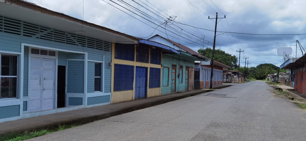
Despite all these transfers of institutions and the construction of three Housing Mortage Bank (BANHVI) housing projects to relocate the population, with an investment of more than 4,500 million colones (about $7.26 million), the inhabitants of Puerto Cortés refuse to leave the original settlement of the city. The original downtown is still home to many, with some businesses that are still struggling to survive.
Olger Mora Herrera has been the owner of Tienda y Ferretería el Aterrizaje for 30 years.
“The owner was Chinese. I do not have the exact date of when it was built, but it is one of the first buildings when this village was El Pozo; it must be very close to one hundred years old,” says Olger. “The original owner had sold it to another Chinese person, from whom I bought 30 years ago. It has always been called El Aterrizaje, and it has always been a store. About 15 years ago, I also decided to open a hardware store in the same location.
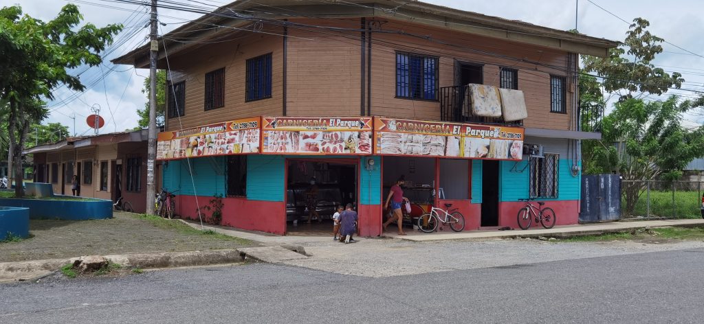
“I have not left here, first because of the roots of the business,” adds Olger. “Besides, it works well here. People still like to come to Cortés Centro to shop.”
“There is no urban planning and distribution in the entire Southern Zone like the one in the center of Puerto Cortés”, says Javier, still sitting on the pier. “With perfect quadrants with its streets and avenues, it’s something worth rescuing. We can take advantage of all that banana history to exploit our town for tourism.”
So far, the relocation of the historic town has not been enough to solve the problem of floods in Puerto Cortés. So the city now has its eyes set on the solution that served them in the past: a new levee system, inspired by the one built and left behind by the United Fruit Company.
“The dikes must be built as soon as possible,” says Oldemar, who as a community leader is one of the promoters of the project. “There is nothing that can completely stop the full force of the Térraba River, so I could not say that with the dikes there will be no more flooding, what I can assure you is that the effects would be greatly mitigated and we would be given time enough to carry out evacuations and never lose lives again due to these phenomena.”
Going back in time
“Although it is true that efforts have been made to take important institutions out of the floodplain areas,” says Jesús Mora Villalobos, Vice Mayor of the Osa Municipality and coordinator of the Cantonal Risk Prevention Committee, “this municipality has been carrying out all possible actions so that, far from disappearing, the original downtown continues to grow and can once again be a prosperous and thriving place.”
According to Jesús, the local government is to encouraging construction on stilts and improving drainage and channeling of river waters, as well as the drainage of some streams and streams.
“We want the Center of Cortés to become a tourist destination,” says Jesús, “and an expansion towards [the coastal highway] in terms of government institutions and some industry.”
However, for the local government, the definitive solution is the clear: “The dam construction project, with a total cost of 10,622 million colones” (approximately $17 million). According todocument SENARA GG-0323-2020, this project will be carried out in three stages.
The first stage is the dike in Palmar Norte with a series of breakwaters, which are non-linear structures built with large stacked blocks of rock or precast concrete elements. These are placed in the water with the intention of increase the flow in several determined directions and thus be able to channel the river. This dam will have an extension of about 4 kilometers.
In the second stage, the Palmar Sur and Cortés dikes will be built. In Palmar Sur and towards “the farms” (populations of Palmar Sur that were developed near the main banana plantations at the time of the United Fruit Company), some 11 kilometers of dike will be built, and a little over 3 kilometers in Cortés.
The third and last stage is the dredging of the Térraba River. This is the most expensive stage of the project, exceeding 4 billion colones (approximately $6.4 million).
According to the Deputy Mayor of Osa, the budget for the project is already available; the designs, studies and requirements have already been finalized; and the process of awarding the contract is already underway.
“The budget for the first two stages is already in place,” says Jesús. “We are in negotiations with the owners of some properties that will be affected by the construction of these dams, but we hope to have the bidding process ready very soon.”
Jesus says it is clear to him that the new levees will not be a magic bullet.
“In terms of risk management, there is no elimination of risk. Rather, risk is minimized,” says Jesús. “The levees are being built to minimize the effects of weather events, but it can never be said that the risk is eliminated. We do believe that this project will bring security to the entire sector of the center of Cortés, which will be protected.”
In other areas of the country, levees have become excellent allies against floods. Such is the case of the dam in Matina, in the province of Limón which was rebuilt in 2019 after damage caused by heavy rains in July 2018. This dam contains the reservoirs of the Matina and Chirripó Rivers.
The community of Nosara, in Guanacaste, also depends on a dam to safeguard the community from the flooding of the Nosara River. This dam was built in 2014, but as a result of Tropical Storm Nate in 2017, it suffered serious damage. Some of the damage has been attributed to the quality of the cement used, which is why this construction is now subject to legal proceedings. However, due to its importance, the dam has already been rebuilt.
For the residents of Puerto Cortés such as Javier Barrantes, the levees seem to be the way to bring peace and hope.
“This is my town and that of many generations born in Puerto Cortés,” Javier says, smiling, as he looks at the Térraba River from the pier. “Puerto Cortés is the cradle of the history of the banana enclave in the South Zone and that history is what will allow us to move forward. This town is a mixture of Indigenous, Chirican and Chinese, and people who came from all over Costa Rica. It cannot die.”
Author

Related Articles
The fishing life in Tárcoles, amidst nets and tourists
Families in Tárcoles, on Costa Rica’s Central Pacific coast, have relied on small scale fishing for years—but this way of life is increasingly precarious. An alternative, fishing tours, has brought new opportunities.

The school that opened the sport fishing industry to women
In the world of sport fishing, women participate in pre-fishing activities (such as preparing food for the crews) and post-fishing activities (filleting, selling the catch, and cooking). A school that started in Guanacaste and is now located in Puntarenas seeks to integrate women into the workforce on tourist and sport fishing vessels.
